Gettin' High in Colorado
High Lonesome 100 | Ultramarathon #089
 |
| Pre-race Portrait: Mile90 Photography (Rick & Kristi Mayo) |
 |
| Photo: Mile90 Photography (Rick & Kristi Mayo) |
Preparation
July is an interesting month in our household. My wife has always used this opportunity to take the school summer break and head back to her home for the summer holidays and partake in her family reunion each year on the California coast. At year with the pandemic, I took the opportunity to work remotely and go with my family out to California. Yet again, 2022 presented a similar opportunity. With the flexibility of my current job role and the blessing of my awesome boss I was able to go with my entire family again for a summer getaway. With the draw of the oceanfront only 3 miles from the doorstep and 3,000’ mountains literally out their backdoor my in-laws house always has had a nice draw to me as an ultrarunner. (My wife was lucky to grow up in such a scenic portion of California).
In the middle of June we packed the van full of our luggage (along with my own storage of running gear and a few pairs of shoes) and headed west towards the Pacific Ocean. I packed in a lot of vert and mountain running in Santa Barbara, as I now know those trails very well from all our visits over the past decade. I had to take advantage of my last week or so of true training before my taper would begin for High Lonesome. This meant I focused on lots of hiking and running downhills to “season my quads” as they say.
A bonus week of training popped up when we decided to go to my in-laws cabin up in northern California Sierras (Arnold, CA) for a week. While still working remotely I was able to live, run, and sleep at ~5,000 ft elevation which was a nice little intermediate step towards heading to CO at the end of July. I even drove up to 9,000’ one day at Ebbett’s Pass on the PCT (Pacific Crest Trail) and just enjoyed the afternoon up higher. I used this week as my last training taking it easy and just trying to let my body get used to some altitude.
 |
Loading up my rental Kia Soul with my Victory Sportdesign bags.
Photo: Katie Meding |
Back to Santa Barbara for a week and then I was off to Colorado for HiLo. I rented a car and decided to drive out to avoid the clusters of airport travelling with all the delays and cancellation that have been occurring. I just wanted to be sure I would get to the race logistically that was within my own control. Secondly the car rental was basically the same price as a roundtrip ticket, and that is before transportation once I landed. I don’t mind driving on long trips so the 15 hours of driving was not a deterrent. Wednesday of race week I set off East through Los Angeles then into Nevada, briefly across the corner of Arizona, across Utah, and finally into the heart of the Rockies within Colorado. The trip took me about 20 hours as I stopped and had a nice nap during the wee hours of the night. This meant I was able to enjoy the day adjusting and walking around Buena Vista, CO before the packet pickup and pre-race meeting. A nice coffee stroll along the river enjoying the views followed by a small lunch run around the hills above the river overlooking BV (sidenote: I recalled these trails from the start of Trans Rockies Run back in 2019). A small lunch and nap in my car before heading to the high school for packet pickup. I had to present my Colorado CORSAR card and also bring my shoes to wash (i.e. the Toad Bath).
All the nearly 150 runners, the pacers, and their crews were gathered into the high school gym as we listened to the race briefing. All the details and traditional messages were given out. After the meeting everyone piled out of the gymnasium and headed for their respective quarters for the night. For me this meant driving out to the start/finish line just outside of town and car camping in my little rented Kia Soul. True 100 Mile mountain ultras require dirtbag camping to have the true experience in my opinion.
The Race
 |
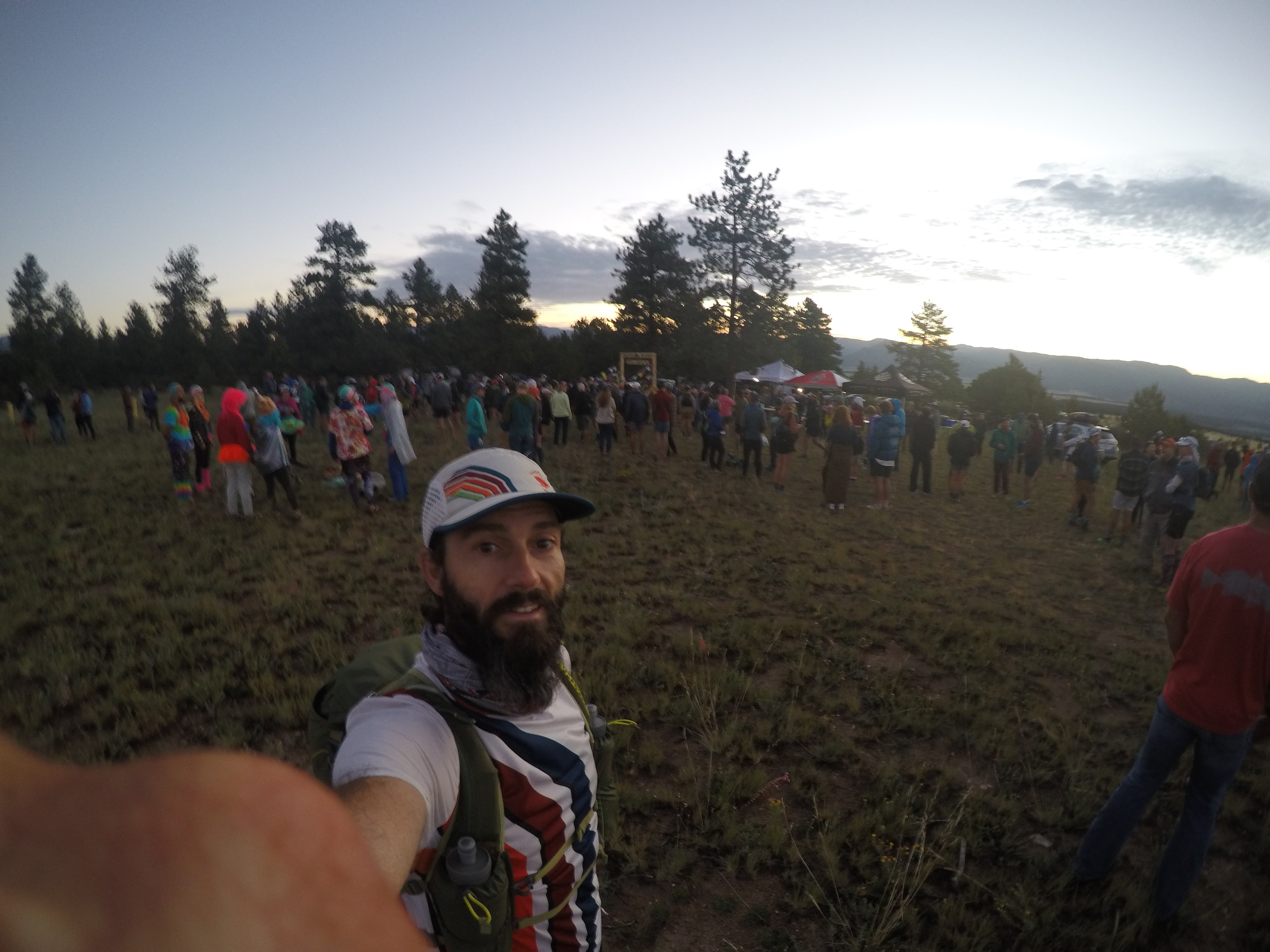
| Start Area. Pre-race gathering at sunrise. |
The morning was a nice crisp fresh mountain air despite being a bit chilly. There was not a cloud in the sky from what I could see and so we knew the morning chill would not last long at all. The start arch was in a large open field just a few miles south of Buena Vista. Runner check-in for the morning consisted of a mandatory gear check (for the required “basic gear”) before being allowed to line up in the chute. A quick photograph from Mile90 Photography under the starting arch and I was ready to go. A 06:00 start coincided with the sunrise slowly creeping up over the mountain range to the East. The first 2 miles of the race was down the paved county road and into a small dispersion of houses in the bottom of the valley of Mount Princeton Hot Springs. Another 1.5 miles on some gravel and we got to the CT (Colorado Trail) junction where we hopped onto singletrack and started heading up the mountain into the San Isabel National Forest. I settled into a smaller congo line of sorts following a group varying between 6-10 runners. The time flew by as it usually does in the first miles of a race due to the excitement and joy of the ultra event itself. Raspberry aid station was the first stop after an hour and a bit of running, 7.3 Mi into the journey. A refill of water and a piece of watermelon then I was off again.
Leaving the Raspberry aid station there was a short flat section through the forest and then the climbing began. I looked down at my Garmin fēnix® 6X to see what was ahead of me. I had the .gpx of the course preloaded and so I was using the ClimbPro visual navigation during the run (This is such a great feature of Garmin to see the data mid-run. I really enjoy this for my longer ultras). What I gained from this glance at my watch was the fact I had 5.2 Mi to go…UPHILL…before cresting out at the top of the saddle between Mount Antero and Mount White. This turns out to be the high point on the course (13,108’), although we would get above 12,000’ many times over the course. What a grind. The views at the top were astounding and well worth it.
 |
| Mount Antero Pass. Photo: Mile90 Photography (Jordan Chapell) |
 |
| My view from Mount Antero Pass down onto the descent ahead of me. |
A long downhill portion took us past the small town of Alpine, paralleling the creek and old quarry railway all the way over to the next big aid station of St. Elmo. There was lots of great energetic volunteers here awaiting the runners and was great to see. Leaving St. Elmo we embarked on the only true out and back of the course up 3 Mi to the top of Laws Pass (12,296’) and nearly 3 Mi all the way down the otherside to Cottonwood aid station. Loaded up on a bunch of calories and downed a bunch of hydration here, before refilling my Tailwind and heading back. The next 6 Mi was a retracement of what we just did and so I knew what lie ahead of me. Leaving Cottonwood aid station there was another mandatory gear check where the “divide gear” was checked, along with the “basic gear” originally. What I like about this process is that the HiLo volunteers actually made us take everything out and show each item before signing us off. I have been in races before where it is more of a check-box process and not actually thoroughly checking the items – so good job HiLo for ensuring runner safety for their own good!
Along the hike back up to Laws Pass I passed many runners and even a few I knew heading down. I met my two other rabbitELITEtrail teammates whom were also running (Tara Warren and Rachel Kelley). After the long grind back to the pass I stopped briefly at the top where on of the Mile90 Photographers snapped a shot of me with the sign. I took in the views again briefly before gearing myself up for the 3 Mi downhill back down into St. Elmo.
.jpg) |
| This was my second summit of Laws Pass. Photo: Mile90 Photography (Rick & Kristi Mayo) |
Next section was the long portion on the CDT (Continental Divide Trail). It was remote and beautiful traversing through Tin Cup aid station, pass Alpine Tunnel and all the way towards Hancock aid station. Upon reaching Hancock it represented the halfway point of the course, mileage wise. I reached this point in approximately 14.5 hours. After spending a good 20 minutes in the aid station recharging and get some calories in I embarked onward with my kogalla waistlamp at the ready. Passing around Hancock Lake the sun was fully ducking behind the mountains now, and I resorted to turning on my light. A short but steep climb up Chalk Creek Pass was a unique experience as I peered up at the headlamps weaving back and forth on the switchbacks that awaited me. The weather remained a nice warm temperature as the night sky now fully engulfed the landscape.
Eventually I found myself at the Lost Wonder Hut aid station. I recall having some amazing perogies here that were delightful and just what I needed. A nice volunteer was keeping me company and decided to give me his opinion of the upcoming section. He was warning me of the impending climb that I was about to head into, which turned out to be correct. This section was a total net gain (+2,722’) with little net down, but the good news was this was the last “big” climb of the course. It seemed to take forever probably due to a combination of being exhausted and being the middle of the night at this point. The grind to the top of the divide lead us along a long ridge at the top where an aid station appeared in the distance. Appropriately named Purgatory (as one volunteer said because “you have just run through hell” after completing 100km + and having to grind up that climb). The aid station was situated right at the top of Monarch Ski Area still sitting at over 11,000’. At this point in the race it was the last high altitude portion of the course as is was all [net] downhill from here to the finish back at ~8,000’. In fact the next section of the course all the way to Fooses Creek aid station was all downhill losing nearly 3k in elevation – a real quad buster at this point in the race.
The next sections of the course I don’t really recall a lot about since it was back into sunrise conditions combined with the fact I was tired. I think I was just zoned out trying to keep moving forward the best I could. Eventually emerging at Blanks aid station at the base of Mount Shavano where there was lots of crew awaiting their runners. Passing the various parking lots and trailheads in this section showed me just how popular the mountain scene is during peak summer season. People were everywhere enjoying the outdoors.
A stretch of 9.6 Mi back to the original Raspberry aid station and I would be now aiming to get the course complete. From here it was all familiar trails as this was the “stick” portion of this large lollipop shaped course (minus the one out & back over Laws Pass). The heat of day two was creeping in fast as it seemed to be even warmer. I focused on drinking my water and ensuring to consume my 2 soft flasks in my hydration vest between the aid stations. One trick I often due to take one out and hold it in my hand to make it easy to access. It reminds me to take small constant sips. Two notable climbs remained between me and achieving my buckle finish.
Once I conquered the first of these climbs I ran the downhill best I could back on the count road 290 which lead by into the Mount Princeton Hot Springs area. Now only one last climb up the “Swear Hill” which is a 500’ climb up the paved road before a very short run back into the open field where it all began a mere 31+ hours ago. Lots of crews and volunteers were driving by either leaving the race, tracking their runners, or commuting back to various aid stations. They would honk and give words of encouragement during these last 2 miles on the road which was nice to hear for sure. Shortly before the 32 hour mark I managed to run through the last portion of the field and complete my journey of High Lonesome 100.
 |
| The Finish (Mount Princeton in background). Photo: Mile90 Photography (Rick & Kristi Mayo) |
 |
100Mi Finish Line feels. Photo: Mile90 Photography (Rick & Kristi Mayo)
|
Course Description
HiLo has a high point of 13,100’, and an average elevation of 10,425’. The course goes over Antero-White pass, Laws Pass (twice), Alpine Tunnel Pass, Chalk Creek Pass, and Monarch Pass. The course is 67% singletrack, 26% mining roads, 3% gravel roads, and 4% paved.
 |
| Alpine Tunnel Pass. Photo: Mile90 Photography (Jordan Chapell) |
Results
101.02 Mi | 21,195 ft+ | 31:54:04 | 42nd Place
STRAVA activity: High Lonesome 100 (42nd overall), Buena Vista, CO | Run | Strava
Official Results: OpenSplitTime: Full results - 2022 High Lonesome 100
Gear List
Shirts: rabbitELITEtrail team kit SS &
rabbit UPF deflector LS
Shorts:
rabbit 5" shredders 2-in-1
Jackets:
rabbit swish PRO (Hawks edition)
Shoes:
Altra Olypmpus 4.0
Socks:
Dry Max
Headwear:
rabbit (BOCO) rabbitELITEtrail cap
Sunglasses:
goodr (rabbit PR edition)
Gloves:
rabbit (BOCO)
Watch:
Garmin fēnix® 6X - Pro Solar Edition
Lighting:
kogalla RA Adventure Light (waistlamp)
Hydration:
NATHAN Trailmix 12 L race pack with 1.6L bladder & x2 20oz Nathan soft flasks
Trail Racing Over Texas collapsible cup
NATHAN VaporKrar WaistPak (used to carry my kogalla waistlamp)
Anti Friction lube: Trail Toes
Poles: none
Emergency Bivy:
SOL
Gear Bags:
Victory Sportdesign (Grizzly Backpack)
Extra Required “Cold Divide Gear”
Jackets: Altra Wasatch hooded jacket (taped seams)
Pants:
rabbit Before And Afters
Secondary light source: Nathan Sports Halo Fire (headlamp)
 |
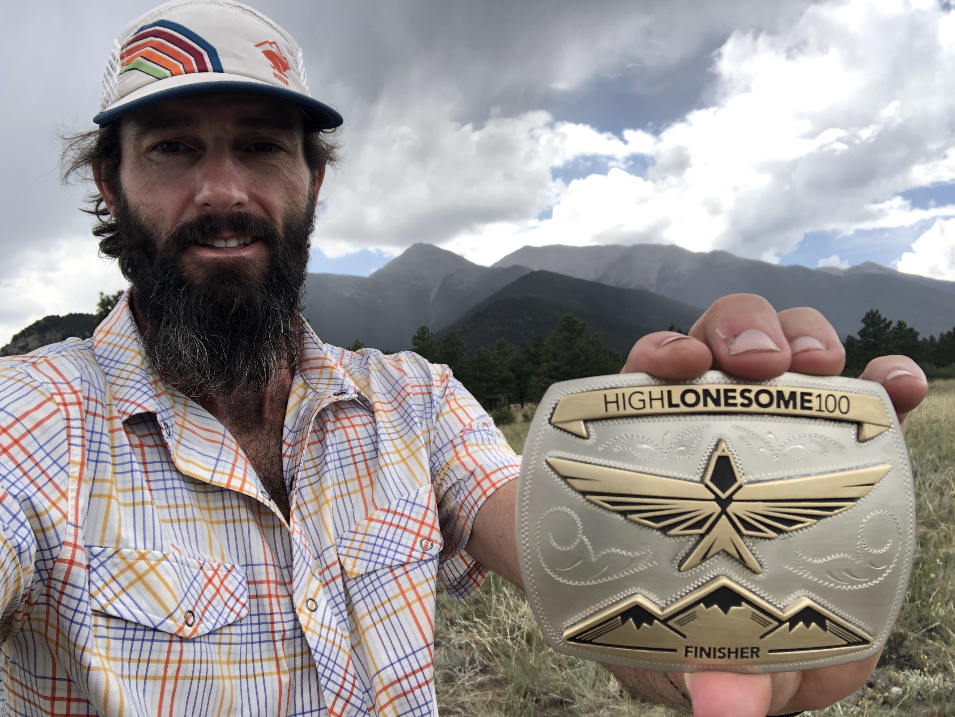
My beautiful hard earned buckle.
This was my 31st race of 100 Mi or more. In total, I have completed 28 of these resulting in 90.32% completion rate.
HiLo was my 89th ultramarathon. |
Thank you everyone for following along on my blog and reading my race reports. I hope you get some insights into the races I write about or even pick up on some tips from a crazy person who likes to run a lot of ultras. Please reach out if you have further questions or post a comment below. Thank you.
Confirmed next up:
- Aug-06 | Capt'n Karl's Colorado Bend 60km Night Trail Run (Bend, TX)
- Sep-17 | Barkley Fall Classic (Wartburg, TN)
----- ----- ----- ----- -----
#ultrarunningdad


.jpg)




.jpg)